
Travel Map Animator
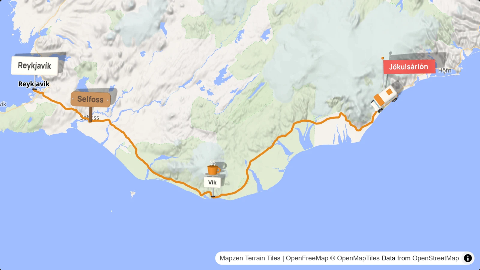
Your travel route as an animated map in your video. Set the points, pick vehicles, signs and camera, and export an MP4 for YouTube, Reels or TikTok.
Desktop required
This tool only works on a desktop or laptop browser. Copy or share the link, then open it on your computer.
I build the Creator Tools alone and keep them free.
Servers, software and hardware cost €1,536 a year. €749 is covered so far, €787 is still needed.
Features
Route
Set points with a click or through the place search. A stop gets a pause, a waypoint only shapes the route. The line follows the road or runs freely.
Eight vehicles
Car, motorbike, camper van, bicycle, on foot, train, boat and plane. Each point can switch to another one. Flights arc across the map.
27 signs
Place signs, road signs like roadworks or a station, breaks with coffee, a tent or a picnic basket, and photos in a circle or a square. Set size, rotation and lead time for each sign.
Photo gallery at a stop
Up to 10 photos play during the pause at a stop. Three looks: out of the point, as instant photos or in speech bubbles.
Camera
An overview of the whole route, follow along with north up, or chase the vehicle from behind at an angle. The motion is cinematic, balanced or sporty. You can switch at any point.
Start and end
Start from the globe, zoom in or orbit. End by zooming out, flying out to the globe or fading out. The vehicle pops up or drops from the sky.
13 map styles
Five standard maps and eight themes such as Old atlas, Blueprint, Neon night or Golden hour. Terrain shows mountains and valleys as relief.
Map content
Show or hide place names, roads, borders, water and sights. Names appear in the local language or in one of 16 languages. Add a compass and a distance counter to the picture if you like.
Line
Ten colors or your own, solid, dashed or dotted. The line can change at any point.
GPX
Load tracks from a navigation device, a tracking app or a sports watch. Pauses from the GPX times come along, with a coffee sign. You can also save your route as GPX.
Scenes
Several routes in one project, for example one per travel day. Duplicate scenes, or start the next one from the end point with one click.
Live view
Drag the timeline and see exactly the frame that goes into the video. Changes to points show up right away.
Export
MP4 in 16:9, 9:16 or 1:1, in Full HD or 4K, at 24 to 60 frames per second. Your browser renders the video itself.
Save
Save projects as a file or in your Google Drive. The browser also keeps a backup, and Ctrl+Z undoes steps.
How it works
Set the route
Click on the map or search for a place. Each point is a stop or a waypoint. You can also load a GPX file.
Add the details
Choose vehicle, sign, pause and camera for each point. The live view shows you the result right away.
Export the video
Pick format, resolution and frame rate, and your browser renders the MP4. Copy the map credit with one click.
Made for
Travel vlogs and road trips on YouTube
Shorts, Reels and TikToks from the road
Bike tours, hikes and pilgrimages
Motorcycle tours and mountain passes
Sailing trips, ferries and cruises
World trips with flights between the legs
Honeymoons and family holidays
School projects, lessons and talks
Frequently asked questions
Does it cost anything?
No. Travel Map Animator is free, you need no account, and there is no watermark in the video.
Can I publish the video, also commercially?
Yes, with a credit. The map data comes from OpenStreetMap. So name “© OpenMapTiles © OpenStreetMap” and openstreetmap.org/copyright in the end credits or the description. The “Copy map credit” button puts the text on your clipboard. With terrain, also credit “Elevation: Mapzen Terrain Tiles”.
Where do my photos and projects stay?
With you. Your browser processes the photos and the video, and you save projects as a file or in your own Google Drive. Only for the map, the place search and the road routes does the browser contact open map services.
Which browsers work?
Chrome and Edge, as well as Brave, Opera and Vivaldi. You need a computer; the tool does not run on phones or tablets.
Can I use a GPX file?
Yes, via File → Import GPX. Each track becomes a leg, and times and pauses from the file go into the travel time. You can also export your route as GPX.
How long will the video be?
You decide, through the duration of each leg and the pauses at the stops. “Distribute” splits a total time across all legs by distance.
Can I show my own photos?
Yes. A photo sign shows a picture right on the map, and a gallery at a stop shows up to 10 photos during the pause. JPG, PNG and WebP work.
Where do I find music for my travel video?
Right here on ENDE.APP. You find royalty-free music for your video in the music search.
Your route as a video
Set the first point and watch the vehicle set off. Right in your browser, no account needed.
Desktop required
This tool only works on a desktop or laptop browser. Copy or share the link, then open it on your computer.
I'm editing a video.
From the screen recording to the closing credits. This is also where the one tool lives that is not a browser tool.
Back to Creator ToolsTravel Map Animator · Map Animator · Travel Map · Animated Travel Map · Route Animation · Map Animation · Travel Route Video · Road Trip Map · Journey Map · Flight Path Animation · GPX Video · GPX Animation · Travel Vlog Map · Reisekarte · Routenanimation · MP4 Export · 4K · 9:16 · Reels · TikTok · Shorts · Free · No Account